22. February 2018 21:11
/
VInsights Team
/
/
Comments (0)
Please click here for the updated version of this post
This Post covers
Coverage Area of Postcode SO40 to SO53
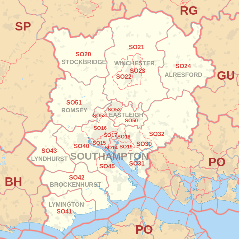 |
| Postcode |
Coverage Area |
Local Authority Area |
| SO40 |
Totton, Lyndhurst, Cadnam, Marchwood |
New Forest |
| SO41 |
Lymington, Milford-on-Sea, Pennington,
Boldre, Hordle, Sway |
New Forest |
| SO42 |
Beaulieu, Brockenhurst, East Boldre |
New Forest |
| SO43 |
Lyndhurst, Minstead, Bramshaw |
New Forest |
| SO45 |
Hythe, Fawley, Blackfield, Calshot, Hardley |
New Forest |
| SO50 |
Town Centre, Fair Oak, Bishopstoke, Horton Heath |
New Forest |
| SO51 |
Romsey, Ampfield, Lockerley, Mottisfont, Wellow |
Test Valley |
| SO52 |
North Baddesley |
Test Valley |
| SO53 |
Chandler's Ford |
Eastleigh, Test Valley |
- M represents Million Pounds
- Total value includes Property Type Other apart from Detached, Semi-Detached, Terraced, Flat/Masionette
Schools for Postcode Area SO
- SO Postcode Area - SO14, SO15, SO16,SO17, SO18, SO19 School Details
- SO Postcode Area - SO20, SO21, SO22, SO23, SO24, SO30, SO31, SO32 School Details
- SO Postcode Area - SO40, SO41, SO42, SO43, SO45, SO50, SO51, SO52, SO53 School Details
Property Posts for Postcode Area SO
All SO Postcodes Yearly & Trend Analysis Posts

Reference
SO Postcode Area As Per Wikipedia
034c419c-7852-436a-bfa3-3dae51192814|0|.0|27604f05-86ad-47ef-9e05-950bb762570c
Tags :