Please click here for the updated version of this post
This Post covers
- Coverage Area of Postcode OL1 to OL9
- Total Sales By Postcode OL1 to OL9
- Average & Median Sales Price By Postcode OL1 to OL9
- Total Number of Sales By Postcode OL1 to OL9
- Property Posts For Postcode Area OL
- Schools for Postcode Area OL
Coverage Area of Postcode OL1 to OL9
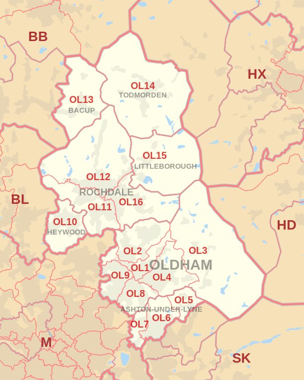 |
| Postcode |
Coverage Area |
Local Authority Area |
| OL1 |
Chadderton, Higginshaw, Oldham |
Oldham |
| OL2 |
Heyside, Royton, Shaw |
Oldham |
| OL3 |
Delph, Denshaw, Diggle, Dobcross, Greenfield, Uppermill |
Oldham |
| OL4 |
Austerlands, Grasscroft, Grotton, Lees, Lydgate, Oldham, Scouthead, Springhead, Waterhead |
Oldham |
| OL5 |
Mossley, Mossley Cross |
Tameside |
| OL6 |
Ashton-under-Lyne |
Tameside |
| OL7 |
Ashton-under-Lyne |
Tameside |
| OL8 |
Bardsley, Oldham |
Oldham |
| OL9 |
Chadderton, Oldham, Westwood, Freehold |
Oldham |
Total Sales By Postcode
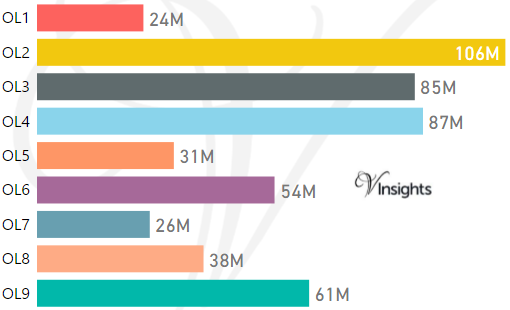
*M represent Million Pounds
Average & Median Sales Price By Postcode
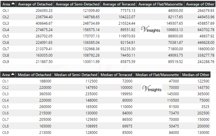
*Average and Median Sales Price are in Pounds
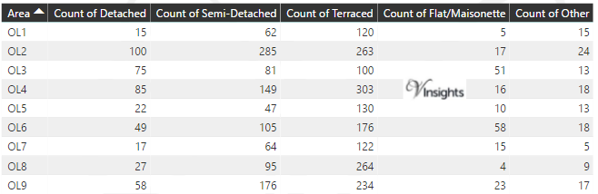
Total Number Of Sales By Postcode
Property Posts for Postcode Area OL
Schools for Postcode Area OL
- OL Postcode Area - OL1, OL2, OL3, OL4, OL5, OL6, OL7, OL8, OL9 School Details
- OL Postcode Area - OL10, OL11, OL12, OL13, OL14, OL15, OL16 School Details
All North West England Postcode Area Posts

Reference
OL Postcode Area As Per Wikipedia
547a5442-2b1b-47b4-b753-aa310ade0f7f|0|.0|27604f05-86ad-47ef-9e05-950bb762570c