Please click here for the updated version of this post
This Post covers
- Coverage Area of Postcode NP20 to NP44
- Total Sales By Postcode NP20 to NP44
- Average & Median Sales Price By Postcode NP20 to NP44
- Spread of Sales Price By Postcode NP20 to NP44
- Total Number of Sales By Postcode NP20 to NP44
- Posts for Postcode Area NP
Coverage Area of Postcode NP20 to NP44
|
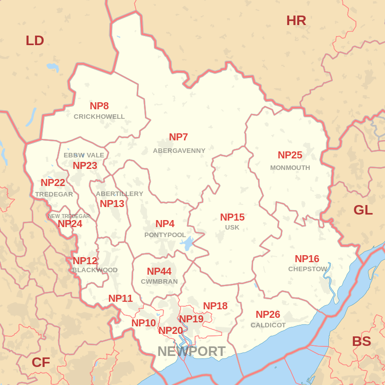
|
| Postcode |
Coverage Area |
Local Authority Area |
| NP20 |
Western and West Central Newport, including: City centre, Pill, Maesglas, Crindau, Malpas, Bettws |
Newport |
| NP22 |
Tredegar, Rhymney |
Blaenau Gwent, Caerphilly |
| NP23 |
Ebbw Vale, Brynmawr, Cwm |
Blaenau Gwent |
| NP24 |
New Tredegar |
Caerphilly |
| NP25 |
Monmouth, Wyesham, Redbrook, Welsh Newton |
Monmouthshire, Forest Of Dean, Herefordshire |
| NP26 |
Caldicot, Magor, Newport |
Monmouthshire, Newport |
| NP44 |
Cwmbran |
Torfaen |
Total Sales By Postcode
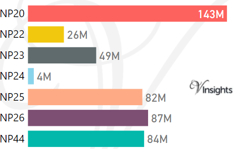
*M represents Million Pounds
Average & Median Sales Price By Postcode
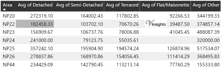
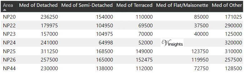
*Average and Median Sales Price are in Pounds
Spread of Sales Price By Postcode
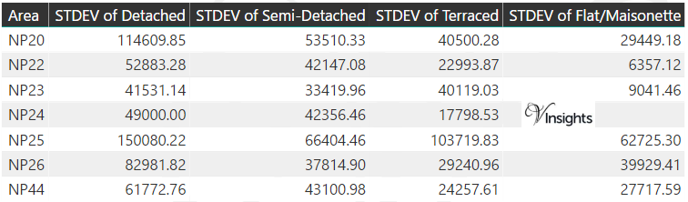
*STDEV is Standard Deviation
For example,
- Say the average detached property price for postcode XYZ is £300 K and ST. DEV. is 30 K.
- It means that most detached properties in postcode XYZ (about 68%) has price within one ST. Dev. i.e. the price range is £270K - £330K.
- All-most all detached property price (95%) in postcode XYZ lie between two ST. Dev. i.e. £240 K - £360 K
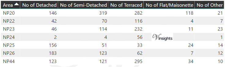
Total Number Of Sales By Postcode
Posts for Postcode Area NP
All Wales Postcode Area Posts

Reference
NP Postcode Area As Per Wikipedia
9ab37f64-6279-45d1-baf2-2c985a617a33|0|.0|27604f05-86ad-47ef-9e05-950bb762570c