23. February 2018 20:57
/
VInsights Team
/
/
Comments (0)
Please click here for the updated version of this post
This Post covers
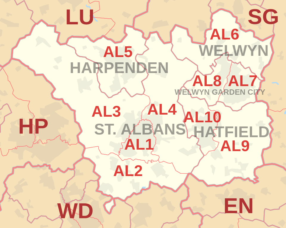 |
| Postcode |
Coverage Area |
Local Authority Area |
| AL1 |
St Albans |
St Albans |
| AL2 |
St Albans, Bricket Wood, Colney Street, Frogmore, London Colney, Napsbury, Park Street, Potters Crouch, Chiswell Green |
St Albans, Hertsmere |
| AL3 |
St Albans, Childwickbury, Flamstead, Gorhambury,
Markyate, New Greens, Porters Wood, Redbourn, Sandridge |
St Albans, Dacorum |
| AL4 |
St Albans, Blackmore End, Colney Heath, London Colney,
Jersey Farm, Marshalswick, Oaklands, Sandridge,
Smallford, Tyttenhanger, Wheathampstead |
St Albans, Hertsmere, North Hertfordshire |
| AL5 |
Harpenden, Kinsbourne Green |
St Albans |
| AL6 |
Welwyn, Ayot St Peter, Ayot St Lawrence,
Digswell, Rabley Heath, Tewin |
Welwyn Hatfield,
East Hertfordshire,
North Hertfordshire |
| AL7 |
Welwyn Garden City (east) |
Welwyn Hatfield |
| AL8 |
Welwyn Garden City (west), Lemsford |
Welwyn Hatfield |
| AL9 |
Hatfield, Brookmans Park, Essendon, North Mymms |
Welwyn Hatfield |
| AL10 |
Hatfield |
Welwyn Hatfield |
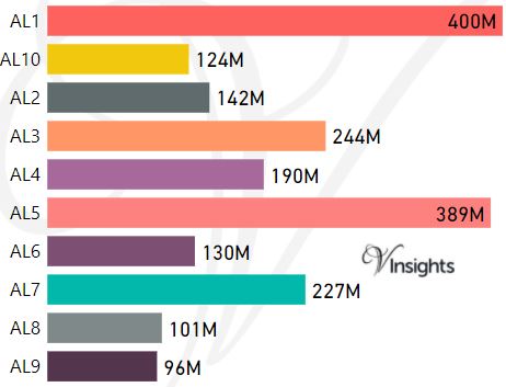
- M represents Million Pounds
- Total value includes Property Type Other apart from Detached, Semi-Detached, Terraced, Flat/Masionette
All AL Postcodes Yearly & Trend Analysis Posts

Reference
AL Postcode Area As Per Wikipedia
f1831c64-db1c-4302-968c-1748b01e80f4|0|.0|27604f05-86ad-47ef-9e05-950bb762570c
Tags :