Please click here for the updated version of this post
This Post covers
- Coverage Area of Postcode WS1 to WS9
- Total Sales By Postcode WS1 to WS9
- Average & Median Sales Price By Postcode WS1 to WS9
- Spread of Sales Price By Postcode WS1 to WS9
- Total Number of Sales By Postcode WS1 to WS9
- Other Property Posts for Postcode Area WS
- Schools for Postcode Area WS
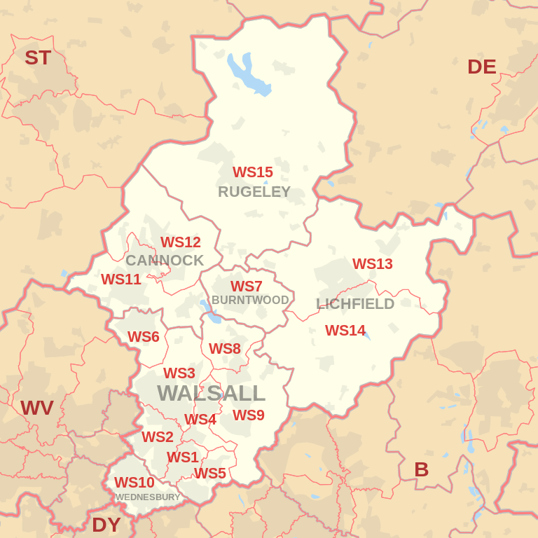
Coverage Area of Postcode WS1 to WS9
|
|
| Postcode |
Coverage Area |
Local Authority Area |
| WS1 |
Walsall town centre, Caldmore |
Walsall |
| WS2 |
Pleck, Bentley, Leamore |
Walsall |
| WS3 |
Bloxwich, Coal Pool, Pelsall |
Walsall |
| WS4 |
Rushall |
Walsall |
| WS5 |
Bescot, Tamebridge, Yew Tree |
Walsall |
| WS6 |
Cheslyn Hay, Great Wyrley |
South Staffordshire |
| WS7 |
Burntwood |
Lichfield |
| WS8 |
Brownhills, Walsall Wood (north) |
Walsall |
| WS9 |
Aldridge, Walsall Wood (south), Stonnall |
Walsall, Lichfield |
Total Sales By Postcode
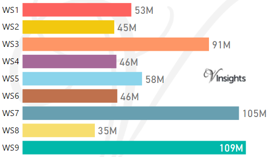
*M represents Million Pounds
Average & Median Sales Price By Postcode
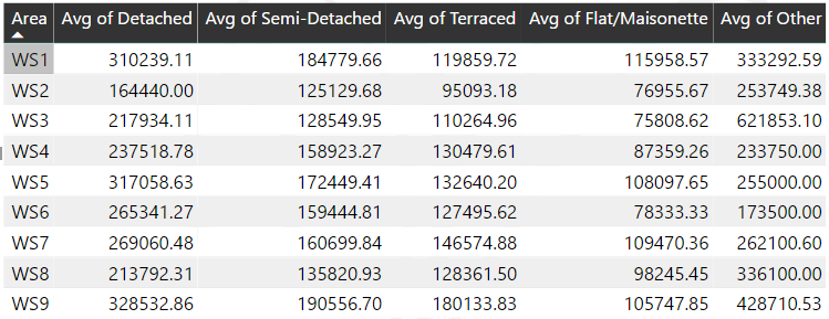
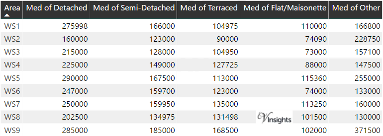
*Average and Median Sales Price are in Pounds
Spread of Sales Price By Postcode
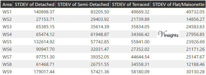
*STDEV is Standard Deviation
For example,
- Say the average detached property price for postcode XYZ is £300 K and ST. DEV. is 30 K.
- It means that most detached properties in postcode XYZ (about 68%) has price within one ST. Dev. i.e. the price range is £270K - £330K.
- All-most all detached property price (95%) in postcode XYZ lie between two ST. Dev. i.e. £240 K - £360 K
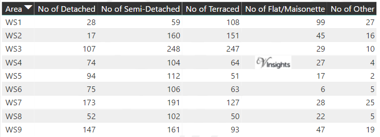
Total Number Of Sales By Postcode
Other Property Posts for Postcode Area WS
Schools for Postcode Area WS
- WS Postcode Area - WS1, WS2, WS3, WS4, WS5, WS6, WS7, WS8, WS9 School Details
- WS Postcode Area - WS10, WS11, WS12, WS13, WS14, WS15 School Details
All WS Postcodes Yearly & Trend Analysis Posts

Reference
WS Postcode Area As Per Wikipedia
27ae4712-6cab-4748-877a-99c1e9ff8454|0|.0|27604f05-86ad-47ef-9e05-950bb762570c