Please click here for the updated version of this post
This Post covers
- Coverage Area of Postcode NP10 to NP19
- Total Sales By Postcode NP10 to NP19
- Average & Median Sales Price By Postcode NP10 to NP19
- Spread of Sales Price By Postcode NP10 to NP19
- Total Number of Sales By Postcode NP10 to NP19
- Posts for Postcode Area NP
Coverage Area of Postcode NP10 to NP19
|
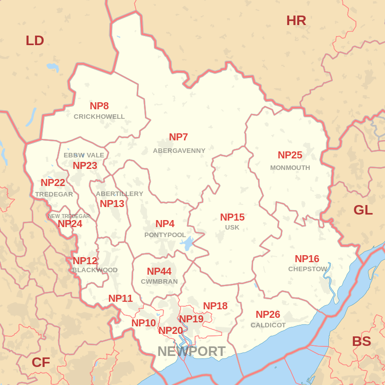
|
| Postcode |
Coverage Area |
Local Authority Area |
| NP10 |
Western Newport, including Bassaleg, Duffryn, Rogerstone |
Newport |
| NP11 |
North-western Newport, including: Abercarn, Crumlin, Cwmfelinfach, Risca, Ynysddu |
Caerphilly |
| NP12 |
Blackwood, Pontllanfraith, Wyllie |
Caerphilly |
| NP13 |
Abertillery |
Blaenau Gwent |
| NP15 |
Usk, Raglan |
Monmouthshire |
| NP16 |
Chepstow, Sedbury, Beachley |
Monmouthshire, Forest of Dean |
| NP18 |
Eastern Newport, including Caerleon, Langstone, Llanwern, Nash, Llandegveth Underwood |
Newport, Monmouthshire |
| NP19 |
Eastern and East Central Newport, including: Beechwood, Maindee, St. Julians, Ringland |
Newport |
Total Sales By Postcode
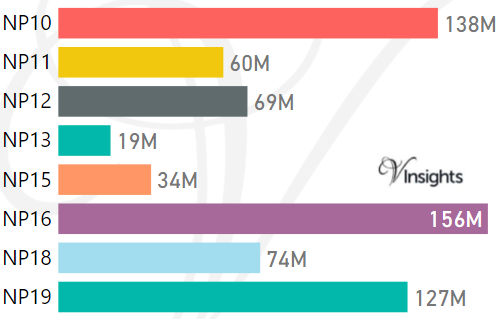
*M represents Million Pounds
Average & Median Sales Price By Postcode
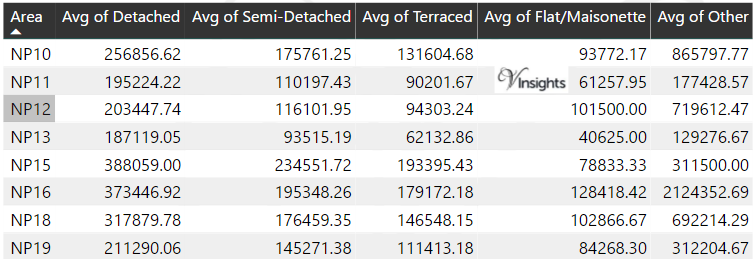
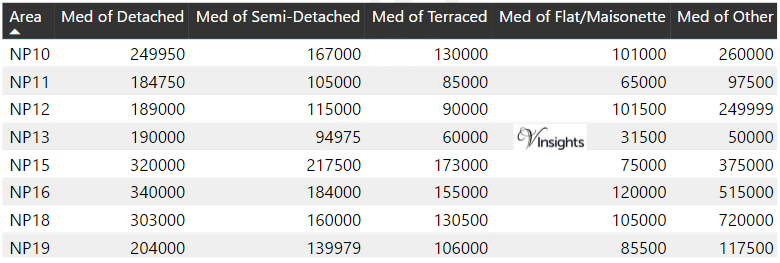
*Average and Median Sales Price are in Pounds
Spread of Sales Price By Postcode
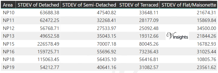
*STDEV is Standard Deviation
For example,
- Say the average detached property price for postcode XYZ is £300 K and ST. DEV. is 30 K.
- It means that most detached properties in postcode XYZ (about 68%) has price within one ST. Dev. i.e. the price range is £270K - £330K.
- All-most all detached property price (95%) in postcode XYZ lie between two ST. Dev. i.e. £240 K - £360 K
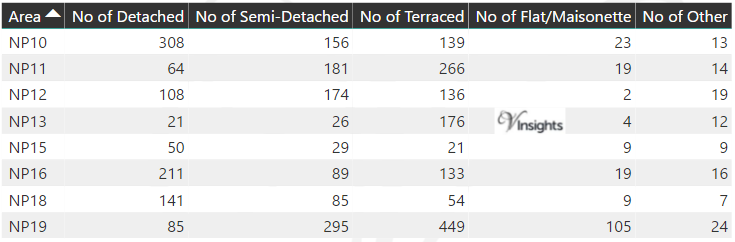
Total Number Of Sales By Postcode
Posts for Postcode Area NP
All Wales Postcode Area Posts

Reference
NP Postcode Area As Per Wikipedia
46c3bead-abb8-404e-813c-0f882d6499b4|0|.0|27604f05-86ad-47ef-9e05-950bb762570c