14. April 2018 23:04
/
VInsights Team
/
/
Comments (0)
Please click here for the updated version of this post
This Post covers
Coverage Area of Postcode WA10 to WA16
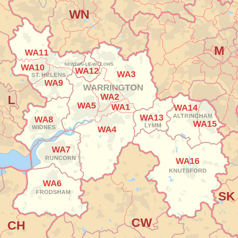 |
| Postcode |
Coverage Area |
Local Authority Area |
| WA10 |
Eccleston, St. Helens, West Park |
St Helens |
| WA11 |
Crank, Haydock, Moss Bank, Rainford |
St Helens |
| WA12 |
Newton-le-Willows, Earlestown |
St Helens |
| WA13 |
Lymm, Statham, Warburton |
Warrington, Trafford |
| WA14 |
Altrincham, Bowdon, Broadheath, Dunham Town,
Timperley, Dunham Massey, Little Bollington |
Trafford, Cheshire East |
| WA15 |
Altrincham, Ashley, Hale, Hale Barns, Timperley, Ringway |
Trafford, Manchester,
Cheshire East |
| WA16 |
High Legh, Knutsford, Mobberley, Ollerton |
Cheshire East |
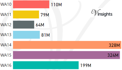
- M represents Million Pounds
- Total value includes Property Type Other apart from Detached, Semi-Detached, Terraced, Flat/Masionette
Schools for Postcode Area WA
- WA Postcode Area - WA1, WA2, WA3, WA4, WA5, WA6, WA7, WA8, WA9 School Details
- WA Postcode Area - WA10, WA11, WA12, WA13, WA14, WA15, WA16 School Details
Property Posts for Postcode Area WA
cf9d7a44-a9b0-47da-8c50-8544f4b92e35|0|.0|27604f05-86ad-47ef-9e05-950bb762570c
Tags :