Please click here for the updated version of this post
This Post covers
- Coverage Area of Postcode SA20 to SA39
- Total Sales By Postcode SA20 to SA39
- Average & Median Sales Price By Postcode SA20 to SA39
- Spread of Sales Price By Postcode SA20 to SA39
- Total Number of Sales By Postcode SA20 to SA39
- Posts for Postcode Area SA
Coverage Area of Postcode SA20 to SA39
Total Sales By Postcode
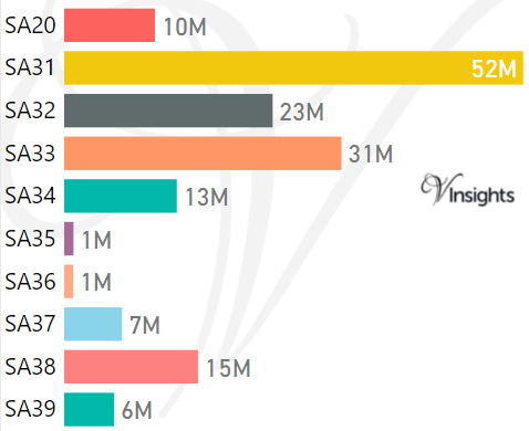
*M represents Million Pounds
Average & Median Sales Price By Postcode
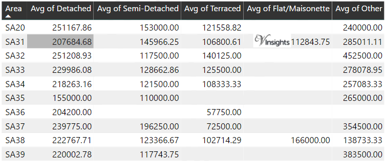
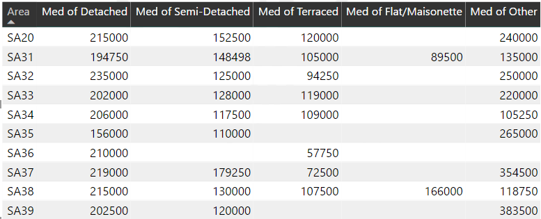
*Average and Median Sales Price are in Pounds
Spread of Sales Price By Postcode
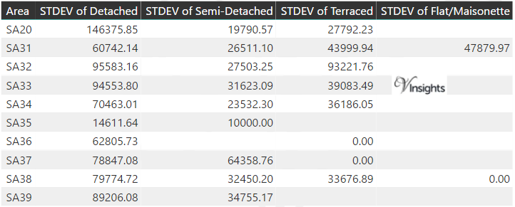
*STDEV is Standard Deviation
For example,
- Say the average detached property price for postcode XYZ is £300 K and ST. DEV. is 30 K.
- It means that most detached properties in postcode XYZ (about 68%) has price within one ST. Dev. i.e. the price range is £270K - £330K.
- All-most all detached property price (95%) in postcode XYZ lie between two ST. Dev. i.e. £240 K - £360 K
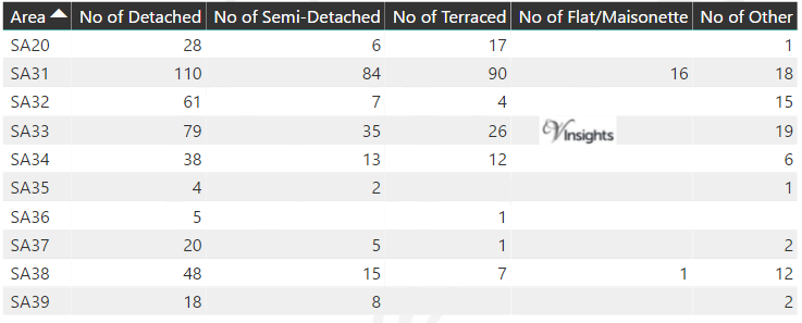
Total Number Of Sales By Postcode
Posts for Postcode Area SA
All Wales Postcode Area Posts

Reference
SA Postcode Area As Per Wikipedia
48de87c2-d5ed-41cd-af23-021d8a29498c|0|.0|27604f05-86ad-47ef-9e05-950bb762570c