 |
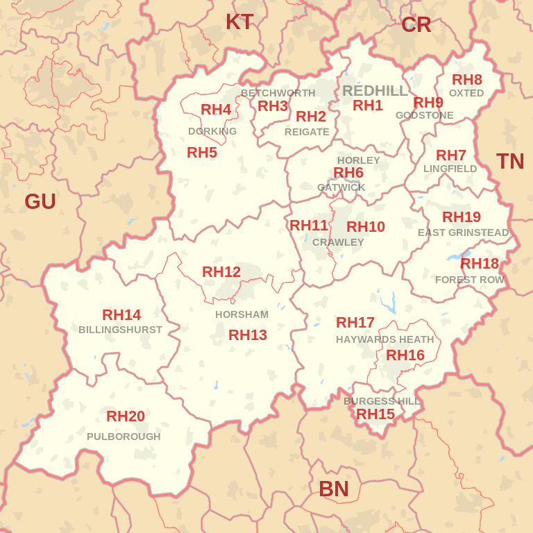
| Postcode |
Coverage Area |
Local Authority Area |
| RH1 |
Redhill, Merstham, Earlswood, South Earlswood, Whitebushes, Salfords,Nutfield Marsh,
South Nutfield, Bletchingley, Outwood
|
Reigate and Banstead, Tandridge
|
| RH2 |
Reigate, Woodhatch, South Park, Skimmington,
Leigh, Dawes Green, Bunce Common, Shellwood Cross,
Nalderswood, Sidlow, Irons Bottom |
Reigate and Banstead,
Mole Valley |
| RH3 |
Betchworth, Brockham, Buckland, Strood Green, Gadbrook |
Mole Valley |
| RH4 |
Betchworth (far west),Dorking, Pixham, Westcott |
Mole Valley |
| RH5 |
Abinger, Capel, Westhumble, Mickleham, Ockley, Holmbury St Mary |
Mole Valley, Guildford |
| RH6 |
Gatwick Airport,Horley, Burstow |
Reigate and Banstead, Crawley, Mole Valley, Tandridge |
| RH7 |
Lingfield, Dormansland, Crowhurst |
Tandridge |
| RH8 |
Oxted, Limpsfield, Limpsfield Chart, Hurst Green, Merle Common, Tandridge, Crowhurst Lane End |
Tandridge |
| RH9 |
Godstone, South Godstone |
Tandridge |