Schools Near Earle Road, Liverpool, L7 6HE
View Large Map
This Post covers
Search All Details for Your Location
Explore Area Information in Detail
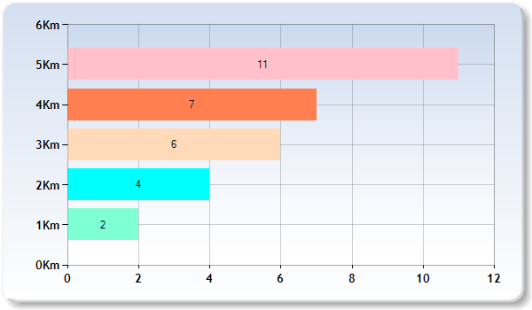
- Km represents Kilometer for eg 2 Km represent Schools within 1 -2 Kilometers
- The above graph represents distribution of Schools from Postcode L7 6HE by distance
Contains public sector information licensed under the Open Government Licence v3.0