VInsights
Amenities
Crime
Census
Property
Schools
Contact
Search
VInsights - Navigation
HP4 3XD Northchurch - Nearest Schools Within 5 Kms of the Postcode
*Circle represents 5 km raidus around the Postcode HP4 3XD
View Large Map
This Post covers
HP4 3XD : Street, Ward, Borough, County Details
HP4 3XD : School Distribution By Distance
HP4 3XD : All Schools within 2 Kms
HP4 3XD : All Schools within 2 - 3 Kms
HP4 3XD : All Schools within 3 - 4 Kms
HP4 3XD : All Schools within 4 - 5 Kms
Amenities Available in the Neighbourhood
Hospitality Premises in the Neighbourhood
Businesses in the Neighbourhood
Property Details in the Neighbourhood
Crime Details in the Neighbourhood
Demographic Composition of the Neighbourhood
HP4 3XD : Street, Ward, Borough, County Details
*Is Active
Street
Ward
Borough
County
Yes
Northchurch
Northchurch
Dacorum
Hertfordshire
*Is Active = It denotes whether the Postcode is Presently Active or Not
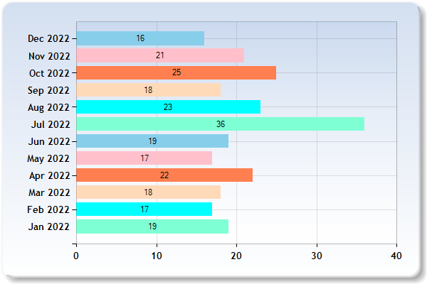
HP4 3XD : School Distribution By Distance
Km represents Kilometer for eg 2 Km represent Schools within 1 -2 Kilometers
The above graph represents distribution of Schools from Postcode HP4 3XD by distance
HP4 3XD : All Schools within 2 Kms
Loading……..
School
School Postcode
*Distance
Phase
Gender
*F.S.
Ofsted
Area
St Mary's CofE Primary School, Northchurch
HP4 3QZ
0.06 km
Primary
Mixed
Y
Rating
Hertfordshire
Westfield Primary School and Nursery
HP4 3PJ
0.67 km
Primary
Mixed
N
Rating
Hertfordshire
Egerton-Rothesay School
HP4 3UJ
1 km
Not applicable
Mixed
Y
Rating
Hertfordshire
Bridgewater Primary School
HP4 1ES
1.02 km
Primary
Mixed
N
Rating
Hertfordshire
St Thomas More Roman Catholic Voluntary Aided Primary School
HP4 3LF
1.36 km
Primary
Mixed
Y
Rating
Hertfordshire
Greenway Primary and Nursery School
HP4 3NH
1.65 km
Primary
Mixed
N
Rating
Hertfordshire
*Distance = It refers to the straight line distance between Postcode HP4 3XD and the School Postcode
*F.S. = Faith School, N= No, Y= Yes
HP4 3XD : All Schools within 2 - 3 Kms
Loading……..
School
School Postcode
Distance
Phase
Gender
*F.S.
Ofsted
Area
Victoria Church of England Infant and Nursery School
HP4 3HA
2.17 km
Primary
Mixed
Y
Rating
Hertfordshire
Berkhamsted Senior School
HP4 2DJ
2.3 km
Not applicable
Mixed
Y
Rating
Hertfordshire
Ashlyns School
HP4 3AH
2.62 km
Secondary
Mixed
N
Rating
Hertfordshire
Berkhamsted Prep and Pre-Prep School
HP4 2SZ
2.7 km
Not applicable
Mixed
N
Rating
Hertfordshire
Swing Gate Infant School and Nursery
HP4 2LJ
2.83 km
Primary
Mixed
N
Rating
Hertfordshire
*Distance = It refers to the straight line distance between Postcode HP4 3XD and the School Postcode
*F.S. = Faith School, N= No, Y= Yes
HP4 3XD : All Schools within 3 - 4 Kms
Loading……..
School
School Postcode
Distance
Phase
Gender
*F.S.
Ofsted
Area
The Thomas Coram Church of England School
HP4 2RP
3.69 km
Primary
Mixed
Y
Rating
Hertfordshire
Aldbury Church of England Primary School
HP23 5RT
3.71 km
Primary
Mixed
Y
Rating
Hertfordshire
Hawridge and Cholesbury Church of England School
HP5 2UQ
3.86 km
Primary
Mixed
Y
Rating
Buckinghamshire
St Bartholomew's Church of England Voluntary Aided Primary School, Wigginton
HP23 6EP
3.9 km
Primary
Mixed
Y
Rating
Hertfordshire
*Distance = It refers to the straight line distance between Postcode HP4 3XD and the School Postcode
*F.S. = Faith School, N= No, Y= Yes
HP4 3XD : All Schools within 4 - 5 Kms
Loading……..
School
School Postcode
*Distance
Phase
Gender
*F.S.
Ofsted
Area
Potten End CofE Primary School
HP4 2QY
4.31 km
Primary
Mixed
Y
Rating
Hertfordshire
*Distance = It refers to the straight line distance between Postcode HP4 3XD and the School Postcode
*F.S. = Faith School, N= No, Y= Yes
Amenities Available in the Neighbourhood
Childcare, Caring Premises
Supermarkets, Hypermarkets
Retailers
Hospitals
Rail Stations
Hospitality Premises in the Neighbourhood
Pubs, Bars, Nightclubs
Restaurants, Cafes, Canteens
Takeaways, Sandwich Shops
Hotels, Bed & Breakfast, Guest Houses
Catering Premises
Mobile Caterers
Caterers in School, College, University
Businesses in the Neighbourhood
Distributors, Transporters
Farmers, Growers
Importers, Exporters
Manufacturers
Property Details in the Neighbourhood
Postcode Level Property Analysis
House Prices in the Neighbourhood of the Postcode
Postcode Sector Level Property Details
Postcode District Level Property Details
Postcode Area Level Property Details
Northchurch Multiyear Trend Analysis of Property Market
Dacorum Multiyear Trend Analysis of Property Market
Hertfordshire Multiyear Trend Analysis of Property Market
East of England Multiyear Trend Analysis of Property Market
England Multiyear Trend Analysis of Property Market
Crime Details in the Neighbourhood
Multiyear Crime Analysis and Statistics
Indepth Crime Details For Year 2019
Indepth Crime Details For Year 2018
Demographic Composition of the Neighbourhood
Northchurch Demographics Compsition
Dacorum Demographics Compsition
Hertfordshire Demographics Compsition
East of England Demographics Compsition
Contains public sector information licensed under the Open Government Licence v3.0