11. February 2018 18:08
/
VInsights Team
/
/
Comments (0)
Please click here for the updated version of this post
This Post covers
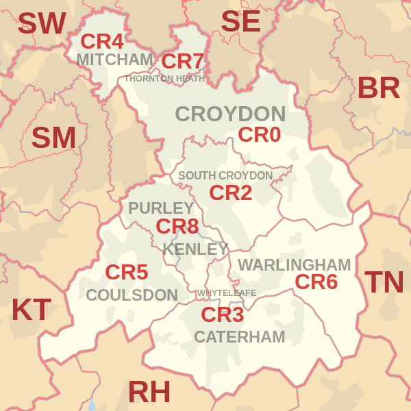
Coverage Area of Postcode CR0 to CR9
 |
| Postcode |
Coverage Area |
Local Authority Area |
| CR0 |
Croydon, Addiscombe, Woodside (part), Selhurst, Broad Green, Spring Park, Shirley, Addington, New Addington, Coombe, Forestdale, Waddon, Beddington, Thornton Heath (part) |
Croydon, Sutton |
| CR2 |
South Croydon, Sanderstead, Selsdon, part of Addington |
Croydon, Sutton |
| CR3 |
Caterham, Chaldon, Woldingham, Whyteleafe, Hamsey Green |
Tandridge, Croydon |
| CR4 |
Mitcham, Mitcham Common, Pollards Hill, Eastfields, Beddington Corner |
Merton, Sutton, Croydon |
| CR5 |
Coulsdon, Old Coulsdon, Chipstead, Hooley, Netherne-on-the-Hill, part of Woodmansterne, Clockhouse |
Croydon, Reigate and Banstead, Sutton |
| CR6 |
Warlingham, parts of Chelsham and Farleigh, Hamsey Green |
Tandridge, Croydon, Bromley |
| CR7 |
Thornton Heath, Broad Green (part) |
Croydon, Merton |
| CR8 |
Purley, Kenley, Russell Hill |
Croydon, Sutton, Tandridge |
| CR9 |
Shirley |
Croydon |
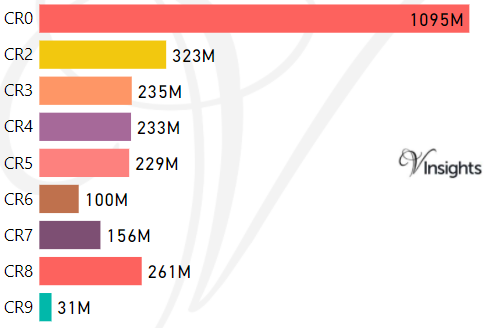
- M represents Million Pounds
- Total value includes Property Type Other apart from Detached, Semi-Detached, Terraced, Flat/Masionette
Schools for Postcode Area CR
Property Posts for Postcode Area CR
f5f30bfe-57c8-48d7-a907-1744e690c31d|0|.0|27604f05-86ad-47ef-9e05-950bb762570c
Tags :