12. April 2018 20:46
/
VInsights Team
/
/
Comments (0)
Please click here for the updated version of this post
This Post covers
Coverage Area of Postcode BB10 to BB18
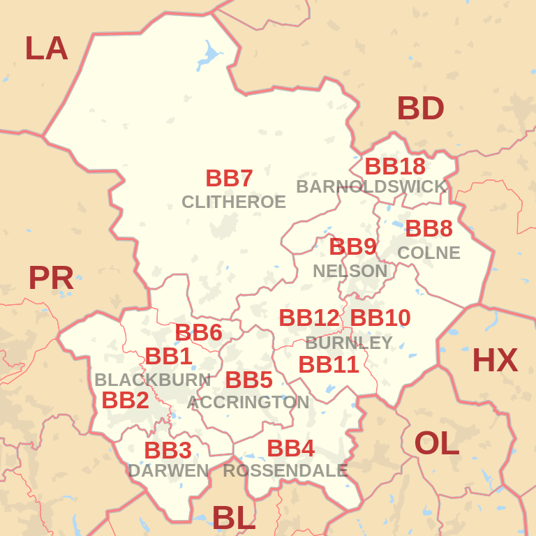 |
| Postcode |
Coverage Area |
Local Authority Area |
| BB10 |
Burnley (east), Cliviger, Haggate, Harle Syke, Reedley, Worsthorne |
Burnley, Pendle |
| BB11 |
Burnley (south and town centre), Dunnockshaw and Clowbridge, Hapton |
Burnley |
| BB12 |
Burnley (west), Barley, Fence, Hapton, Higham,
Padiham, Read, Simonstone, Wheatley Lane |
Burnley, Pendle, Ribble Valley |
| BB18 |
Barnoldswick, Bracewell and Brogden, Earby, Kelbrook, Salterforth, Sough |
Pendle |
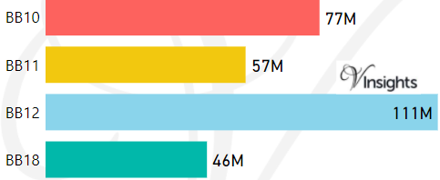
- M represents Million Pounds
- Total value includes Property Type Other apart from Detached, Semi-Detached, Terraced, Flat/Masionette
Schools for Postcode Area BB
- BB Postcode Area - BB1, BB2, BB3, BB4, BB5, BB6, BB7, BB8, BB9 School Details
- BB Postcode Area - BB10, BB11, BB12, BB18 School Details
Property Posts for Postcode Area BB
7fdae548-8282-428e-a349-dd30000560cf|0|.0|27604f05-86ad-47ef-9e05-950bb762570c
Tags :